
Pinglue Fm
Type Locality and Naming
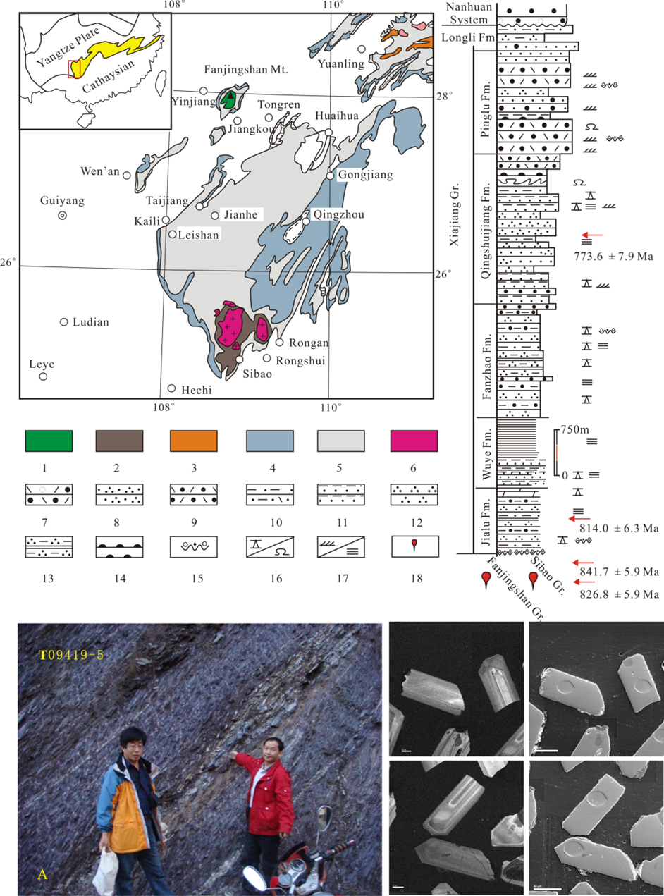
Central easternmost Guizhou. The Pinglue Fm was renamed from the third member of the Qingshuijiang Formation (1962). The Pinglue Formation was named by the Guizhou Party of Regional Geological Survey in 1976 and formally quoted in 1987 (in Regional Geology of Guizhou Province). The typical section is situated in Pinglue in Jinping County, Guizhou Province. Upper-middle formation in the Banxi Gr and in the Xianjiang Gr.
Synonym: (平略组)
Lithology and Thickness
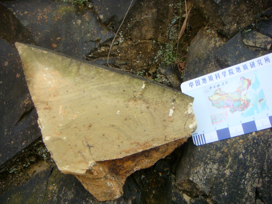
The Pinglue Fm is dominantly composed of light gray, gray and greenish gray sericite slate and silty slate intercalated with minor tuffaceous slate and blasto-sandstone rock. In Taijiang and Leisban area, its lower part is intercalated with blasto-pelitic sediment-tuff, the upper part with red purple sericite slate and the middle-upper part occasionally bears lenses of carbonate rock. In Pinglue, Mengyan and Pingyong, the middle or upper parts can be intercalated with a large lens of blasto-sandstone (several km in length) and occasionally with conglomerate intercalations. From SE to NW, intercalations of tuffaceous slate and blasto-sandstone increase and total thickness varies from 900 to 2200 m.
[Figure: The Stratigraphic column of the Xiajiang Gr. in Guizhou Province. A-Volcanic ash beds in the Jialu Fm and zircons from the ash bed.]
[Figure: The silty slate of the Pinglue Formation (photo by Chen Jianshu)]
Relationships and Distribution
Lower contact
It rests conformably on the underlying Qingshuijiang Fm.
Upper contact
It conformably underlies the overlying Longli Fm.
Regional extent
Central easternmost Guizhou and border with Guizhou.. Jinping County, Guizhou Province. It is limitedly exposed southeast of the line from Tongren to Weng'an and northwest of the line from Liping to Congjiang (the Leigongshan district).
GeoJSON
Fossils
Some slate yields microplants Leiopsophosphaera sp., Trachysphaeridium sp. etc.
Age
Depositional setting
Additional Information